The Lac
Blanc is a glacial lake within the Aiguilles Rouges massif opposite Mont Blanc.
Surrounded by some of the most impressive scenery in the Alps, a hike to the
lake provides picture-postcard views throughout. From the larch forests lining
the lower slopes, to the ibex-covered scrub above and the rocky pillars of the
Aiguilles Rouges, the route is lined with amazing sights. The wider panorama
holds views of Europe’s tallest mountain and numerous glaciers and pinnacles
along the Mont Blanc massif.
The
Lac is billed as one of the most popular hiking destinations in the French Alps
(hence we chose to attempt it in the quieter, winter months). Of the possible
routes, the one described below is the quietest – while the busier routes
utilise the La Flégére cable car (and Index chair lift), this itinerary follows
a serene path rising through a national park well away from the main course.
Time
Allow
half a day (minimum), comprising:
3 hr
to hike up
2
hr to return (on the Echelles via ferrata
route passing the Aiguillete de Argentiere)
Parking
The
route starts from either of the free car parks on the N-506 Col des Montéts
(see our Hikes, Rides & Activities map).
There’s also a regular bus link between the Col and the du Mont Blanc in
Chamonix.
Route
 |
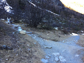
| The route to the Lac splits away from the roadside track |
The
Lac Blanc route is signed from the Col des Montéts car park(s). The trail runs
parallel to the road (on the west side) before splitting off to wind up the
steep mountainside. After several switchbacks (and several hundred metres above
the car park) the path straightens out heading south along the side of the
massif.
The
route then passes through two large bowls, which form part of Le Grand Balcon Sud – a wide,
(relatively) flat terrace on the mountainside. (Oddly, during our winter hike,
all of the signplates had been removed from several of the signposts, along the
way, leaving us to navigate sans
direction over the snow-covered terrain – it was more by luck than chance
that we arrived in the right place).
 |
| Lunch overlooking Mont Blanc at the Lacs des Chéserys cairn |
The
route thereafter climbs steeply up the mountainside, though it was snow-covered
during our winter ascent, so we simply scrambled through snowdrifts up the 55°
incline. Twenty minutes later we arrived at the refuge, its roof lined with yellow-billed
choughs looking out for morsels of food.
 |
| Looking back at the Lac de Chéserys: the route passes around the lake's south bank |
Following
exploration of both lakes, we retraced our steps down to the southern bank of
the Lac de Chéserys and, indeed, to the large cairn where we’d lunched. Taking
the lower path from the cairn (in the general direction of Chamonix), we were
able to recommence the circular aspect of our hike. The path loops back on itself after a short
while to head in the direction of the Col des Montéts.
 |
| The Echelles via ferrata allows passage across high granite cliffs |
Thereafter,
the route is a gentle ramble down to the hamlet of Tré-le Champ, passing
through larch forests on the lower slopes. From Tré-le Champ, a roadside
footpath can be traced some 300m uphill, back to the start of the hike.
 |
| Lac Blanc as viewed from the Lac Blanc Refuge |
 |
| The Lac Blanc Refuge, with the Aiguille du Chardonet and the Aiguille Verde in the background |
No comments:
Post a Comment